We wake up to an overcast day to start our drive around the Gaspe Peninsula. We could have wished for clear skies and a sunny day, but are glad, at least, that rain isn’t in the forecast. We’re over the bridge from Campbellton, New Brunswick, crossing the Restigouche River into Pointe-a-la-Croix on the Quebec side. In days gone by, the Micmac tribe erected a cross here by the river and so gave the town its name. We’re looking at the Appalachian Mountains and I am reminded of the factoid I learned from Mike, who greeted us at the door of la Maison Mackenzie House last night. Mike had told us that the Appalachians, which begin in the American southeast in the state of Alabama and extend all the way up the East Coast into this southeastern edge of Quebec, actually don’t stop at the water’s edge. He tells us that he’s recently learned that they actually extend across the Atlantic Ocean and continue through Ireland and Scotland and on into the Scandinavian countries – the Caledonia mountains. The Celtic traditions are here in Canada’s Appalachian country – New Brunswick and the Gaspe – but here it’s called Acadian country.
Here’s a map that should do nicely for this second leg of our road trip, one that so far has taken us from New Hampshire up to Canada’s East Coast and will continue along Canada’s southern border, crisscrossing into the northern U.S. as we move west. For the next couple of days, we’re hugging the Gaspe Peninsula shoreline, and it ends up looking something like this:
The picture postcard destination is Perce Rock at the very tip of the peninsula, and we wend our way there along the south coast on Route 132, stopping in New Richmond to pick up a map of the Gaspesie and a little booklet that describes the highlights along the way. There isn’t much in terms of man-made attractions that scream out for us to stop, although as the day progresses, I note a trend in church steeples – they’re all silver. In every town we pass through, the silver steeple plays a prominent architectural role.
But it’s not man-made we’re looking for; it’s the natural beauty that holds our attention. Passing through towns with names like Carleton-sur-Mer, Saint-Simeon and Paspebiac, all on the Baie des Chaleurs, which roughly translates into English as the Warm Water Bay, we stop in New Carlisle and head down to the beach to test the warmth and, as it turns out, a bit of hunting for agates, of which I collect a pocketful. The agates are plentiful but the water’s not warm. The seagulls don’t seem to mind, though.
On through Shigawake, Port-Daniel-Gascons, Chandler, and on to Perce, the names speak to the intersection of anglophone, francophone and native in this quiet and picturesque corner of Quebec. We arrive in Perce early afternoon and for the first time today, we are in the thick of people. The streets of Perce are filled with hotels and motels, restaurants and bistros, souvenir shops and clothing stores, all ready to serve the mass population that seeks out Perce as a destination. We perch ourselves away from the crowds to take photos on the south and north side of town, otherwise passing through the town unmolested. I regret now that we didn’t stop – Dexy’s backside would have benefited from a Gaspe sticker, and Perce was our golden opportunity to find one, our only opportunity as it turns out.
From Perce we head north to the town of Gaspe, a working town in its prime, and up to the north coast of the peninsula. Now the mountain range is on our left and we stop at a “view point” in one of the many coves that dot the shoreline along the St Lawrence River.
Farther on up the road, we pull into St. Yvon for the requisite post-Timmy’s pit stop. Route 132 through the Gaspe is dotted with signs for this and that, including ones that point to municipal pee stops, with or without potable water available. St. Yvon’s stop is at a memorial of the day in 1942 when a German torpedo flew through the St Lawrence River, crashing into the cliff, shattering the rock and damaging houses and their contents in the area. Seventy years later, one would never suspect this quiet town had such an explosive history – all that remains is the story and a lovely seating area.
Continuing to hug the coast, the remainder of the afternoon is spent passing through one little town after another – it’s quiet out here in the Gaspe, not a lot of people; instead it’s the full force of nature that fills the space – mountains on one side and the powerful St Lawrence River on the other and every so often we cross over rivers that lead down to the St Lawrence. All day long we have been crossing over rivers and pretty much each sign says Riviere aux Saumons.
Ah, I said, at the first river we crossed this morning on the south shore, this is the Salmon River. It makes sense – this is fishing country. At the next river crossing and the next, I wonder at this mighty Salmon River with its many tributaries. By late afternoon, on the north shore, I look more closely at the signs, and while they all seem to say Riviere aux Saumons, above that is another name – their actual names – Riviere du Grande Cloridorme, Riviere Madeleine … and I am left baffled by this unique way of signing here in the Gaspe.
The St Lawrence River flows from the Great Lakes considerably farther west in the province of Ontario and flows east to empty into the Atlantic Ocean right here. We’re officially on the river, but it feels and looks like the ocean, with the waves crashing into shore. A couple of months ago we were wending our way up Highway 1 along the Pacific Ocean. My dream then was to spend at least one night camping on the ocean beach, listening to the waves crash about my ears. Despite our best efforts, it never happened – we got close, but no cigar. We’re going to try again here on the Atlantic.
Up ahead is the town of Sainte-Anne-des-Monts, and with two campgrounds available, we might be in luck.
We are. We see the sign for Camping du Rivage and pull in. Once again today I am able to practice my French and tell the owner that no, we don’t want a site protected from the wind up here by the office, we want a site right down by the water. He’s happy to oblige, and we set up our tent with our front door opening up onto the beach. I mentally check one more thing off the bucket list.
Meanwhile the wind has really picked up and our cheap Walmart-special tent is no match for it. We pull the picnic table up beside the tent and guywire the tent poles to the table legs with various belts from our shorts and pants. Miraculously it does the trick – inasmuch as the tent no longer bends over with every gust. With beers in hand, salut to a job well done by two amateur girl scouts, and we sit back to enjoy the sunset.
With the wind still howling, we crawl into our tent as night falls, and yes, we can hear the ocean waves, but just barely. What we mostly can hear is the tent’s rain flap, flapping up a storm with every gust of wind. This will never do – not only can we not hear the waves, the noise of the rain flap is surely going to keep us and the rest of the campground up all night. The solution, we decide, is to remove the flap and hope for no rain.
Much better.
But not for long. Drops begin to fall through the now-open top – whether it’s rain or the wind carrying the drops of the ocean, it all amounts to water inside the tent and back on goes the rain flap. Amid all the noise, I am reminded always to be careful about what I wish for.
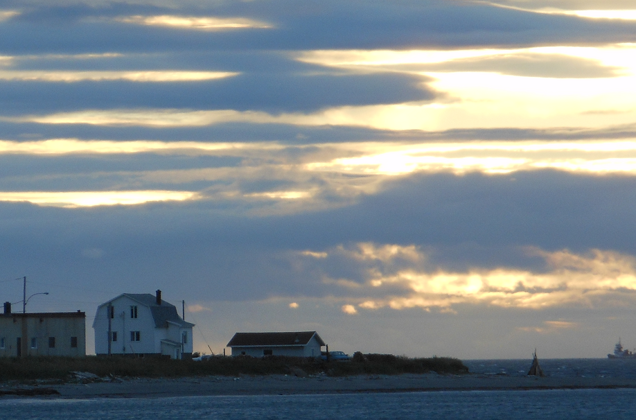
In what can only be described as an historical moment, I am awake at sunrise. I don’t remember the last time I was awake for a sunrise, and I knew no one would believe it without the evidence. Ergo …
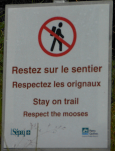
After packing up our belongings in the morning, we head inland to the visitor center at Gaspe National Park, a park with many trails of varying lengths and degrees of difficulty. In our best French, we ask which trails provide the best panoramic views. With a silent sigh of relief, je suis tres relieved when the guide points us to an intermediate trail that leads up le mont Ernest-Laforce, which not only has the best views but will also give us our best chance at seeing moose. Off we go.
Indeed, we are in the land of the moose. And while it wasn’t on my bucket list, seeing a moose up close and personal is a first-time experience for me, and we’ve hit the trifecta – we see a baby moose first, standing on the right side of the trail munching on the greenery. Baby looks at us quizzically and continues its lunchtime munching.
We see Mom Moose in the field to our left, and it occurs to us that the wrong thing to do would be to walk between the two of them; we imagine just how unhappy a mommy moose might get if we come between her and her offspring. So we wait for her youngster to finish up and saunter off to join Mom.
We are free to continue. About a hundred yards up the trail, we deke off into a little path that leads to an edge that goes no farther, and in the field below us, we see Dad on the lookout for predators, we presume.
Our trek to the summit might have been about two and a half miles. The panoramic views of the surrounding mountains are not the jaw-dropping ones of, say, the Rockies or the Alps, but the wind is whipping like we’re at the top of the world and pushes as our backs as we head down to the mountain.
Looking down instead of up provides some of the most interesting sights, on the trail and off …


Back on the road, we head down from the mountains and up to the coast, following the river west that will lead us to Quebec City tomorrow. But tonight we’re staying in Rimouski Est at the Motel de Mer – a seaside motel that grants us a wonderful sunset and a roof over our heads that won’t flap in the breeze.


