Our final days in British Columbia, and we’ve saved the best till last. I wish we had a month on the island, so much of it left unseen, but alas, we have only four days.
We leave Victoria and head north along the Trans Canada Highway, which hugs an inlet on its right. There are a couple of towns I’d like to see on the way, but first, a slight detour inland to Lake Cowichan. It’s the largest inland lake on the island, as far as I know, and not over-inhabited, and I’ve been told people like to retire here. I want to see why.
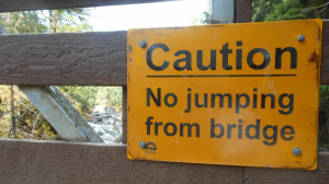
We pitch our tent in Cowichan River Provincial Park, at one of the park’s campgrounds. With just a couple of daylight hours left to us, we head out in search of a hike and find one through the woods along the cliff’s edge …
Back at the campsite, it’s PB&J sandwiches for dinner, followed by a game of cards.
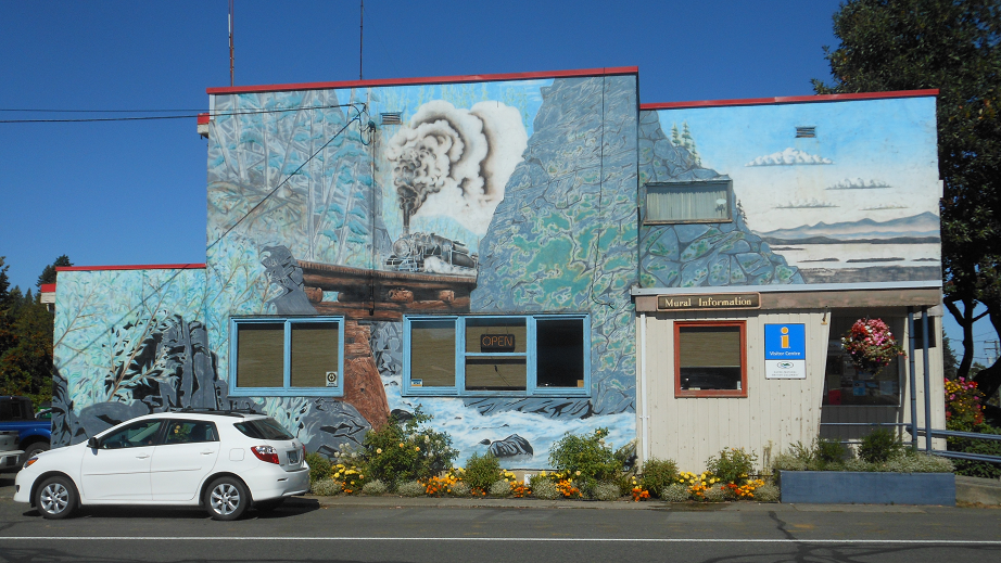
We’re sharp in the morning, heading off to Duncan for a cup of coffee and join back up with the Trans Canada heading north. The first town we stop at is Chemainus, a little town on the eastern shores of the island that reinvented itself from a small industrial/fishing town in decline to a tourist mecca (of sorts). The town is now famous for its wall murals depicting the history of the town. They make for a delightful walk about town, enjoying the streets leading down to the water.
I could have stayed all day, wandering among the artisans and enjoying people’s gardens, but we needs be off to Ladysmith for lunch. We stop in at Renee’s Soup and Sandwich in town and in an original move, we each have soup and a sandwich, after which we did a quick drive down to the shore, just to take a peek …
Continuing north along the coast, we turn west at Parksville onto Hwy 4, a long and winding road that will take us across the island to Tofino. The road goes through a majestic forest and opens up to an inlet, which we follow for miles. Quite the drive.
Tofino is nestled at the tip of a craggy finger of land that juts out from the island’s west coast. There is one road in, leading us through the Pacific Rim National Park Reserve, an area that in and of itself is reason enough to come to the southwest coast of Vancouver Island. We’ll be back to take a hike here tomorrow, but for now, we’ll find a campsite and check out the town.
The town doesn’t cover much territory, with the business area taking in only a handful of streets spreading out from the cove. The western side of town faces the ocean, while the north serves as the entryway to the cove on the east side of town. where boats and water planes share space with the seagulls at dockside restaurants …
Now that we’re back, officially, to the West Coast, sunsets are the order of the day. Two nights in Tofino, two sunsets. The first of many nights as we head down the West Coast to Santa Cruz. But before we get to the sunsets, our hike in the Pacific Rim included heading across, at low tide, to an islan, and heading back as the tide began to roll in. Views from the island …
Saying goodbye to Tofino, we head off late morning for the eastern side of the island, ultimate destination, Nanaimo, where we can get the ferry to the mainland For our last night on the island, we put up our tent in Coombs, leaving an easy drive to Nanaimo in the morning. With most of the afternoon and evening ahead of us, we head over to Little Qualicum Falls for a hike around the park.
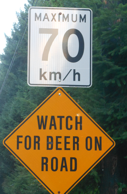
Not a strenuous or long hike, we had enough time to close out the late afternoon at Rathtrevor Beach, on the south side of Parksville. On the way to the beach, winner of the best road sign so far…
From the beach to Cabernet’s in Parksville for a fine dinner before heading back to Coombs. The road there led us through Qualicum Beach, and in another splendid example of the wonderful things that can happen when you take this road instead of that one, as we turned the corner on Qualicum Beach, there was the most spectacular sunset you never expected to see. This on the east coast of the island. Don’t let anyone tell you you have to go to the west side of the island to get an eyeful when the sun goes down.
And so, our trip to the island is over. The next day we board the ferry to Tsawwassen, where Paul and Cheryl and Al are waiting to feed us and find out how our week on the island went. Paul and Cheryl have found the perfect place up the coast, a place remote enough that one has to ferry it from the mainland to the island before taking another ferry over to the coast. That’s all in the northern part of the island. I’m itchy to explore up there; I guess I’ll just have to come back.


