Whoever came up with British Columbia’s provincial motto got it absolutely right. Like the license plate says: “Beautiful British Columbia.” Bridget and I are going to tackle the province in two slices, interrupted by a trip in the middle that will take us to western Alberta to visit family and other fun stuff. We’ve carved out a week for our first B.C. slice, which begins in the town of Nelson, in the West Kootenay Rockies.
The route we’ve planned is in the shape of a C, and Nelson is at the bottom point.

From Nelson, it’s west to the Okanagan Valley, known primarily for its farmland, and then northeast to end up in Revelstoke, back in the Kootenays. Camping and hiking are the name of the game this week, and as good luck would have it, beautiful weather is on our side the entire time. Let the week begin …
Nelson
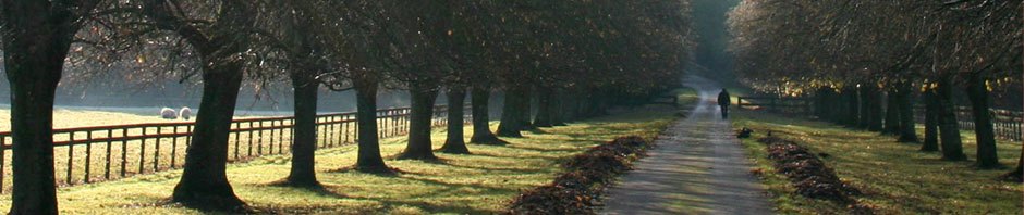
Two nights at Nelson City Campground, a five-minute walk from downtown, and town is where we head for a bite to eat after we set up our tent after a late afternoon arrival. The town is on the west arm of Kootenay Lake, and after dinner we stroll down to the shore to see what we could see.


In the morning we’re off along the Kootenay River to Kokanee Glacier Provincial Park and a hike up to Kokanee Lake. I huff and puff for the first mile, but I find early on that the trick to getting to the summit is stopping frequently to take pictures. It’s not like there aren’t plenty to take.
This is Gibson Lake, at the bottom of the trail up to Kokanee Lake …

View of Gibson Lake farther on up the trail

Up, up, up we go, and it’s gorgeous …


After many, many stops to take ever more flower pictures, we round the corner, and there it is, Kokanee Lake …


Yes, it’s that cold up there at the lake; swimming is not an option today. But a picnic lunch by the shore is in order, lightening our load before our descent to the parking lot. A spectacular hike to begin the week.
Osoyoos
In the summer of ’69, while others were groovin’ to Joe Cocker et al in Woodstock, I was in British Columbia (I think my parents were concerned that I might head off to Yasger’s farm for the weekend, so they arranged to have me be as far away as possible, sending me to the other side of the continent away from all those hippies). My gain entirely. I wouldn’t have known how to fight my way out of a paper bag in those days, let alone find my way from Montreal across the American border into New York. I was visiting my godparents in Vancouver, and it just so happened that my vacation coincided with their vacation to the town of Osoyoos in the interior of B.C. I was 14 that year and had the time of my life in Osoyoos that summer – cabin on the beach, swimming every day, water skiing, trips in the motorboat across the border into Washington, campfires – best vacation ever. I haven’t been back to Osoyoos since, so it was a definite must this trip.
I’d heard it had changed over the years, but what place hasn’t? Gone are the shacks on the beach and the ice cream stand on the corner; now it’s hotels and boutique shops and jet skis. Ah well, who doesn’t like progress? We stopped in at a pub overlooking Gyro Park on one of the many beaches in town. It was a hot day, so we changed into our bathing suits after lunch and went for a swim to cool off before heading up the road to Penticton and our home at the South Beach Gardens campground for two nights.
Penticton

Penticton, like Osoyoos, is in the Okanagan Valley, and when I was 14, this was farm country – fruit, fruit and more fruit. It’s still fruit growing country, but the vast majority of it has been turned over to grapes. We’re in winery country. And like Osoyoos, Penticton is a family vacation destination. South Beach Gardens is a huge campground, and it’s packed to the gills with vacationing families who can take advantage of Skaha Lake beach directly across the two-lane highway through town. We do the same.

In terms of recreational activities, the Okanagan is all about water sports. Hiking just doesn’t come up much, although we’re told that we could conceivably walk Skaha Bluffs on the other side of the lake. The bluffs are for rock climbers, but we decide to give it our best shot. As it turns out, it’s basically all rocks, some of them taller than others. We left the tall ones for the rock climbers to scale while we scrambled over the others to the summit.


Kelowna
North along Highway 97 to Kelowna on Okanagan Lake, and tonight we’re camping at West Bay Beach Resort just south of town. Our tent doesn’t come with air-conditioning, and we wake to the sun beating down on us in the morning. Off to town and the Visitor Center, in hopes of finding a trail to hike. The woman behind the desk doesn’t actually laugh at us when we ask about hiking at Blue Grosse Park, but she might just as well have. Instead she draws directions to the park on a map and wishes us luck.
Worst hike ever. Dusty trails meant for dirt biking, not foot traffic, and certainly not on a hot day like today. Half an hour in, I get a photo of Kelowna across the water …

… whereupon we turned around and headed back to West Bay for an afternoon swim. Later it was dinner in town at the Memphis Blues Barbeque House and a stroll down to Kelowna City Park on the waterfront. As we’re snapping pictures of the setting sun …

… all of a sudden we’re surrounded by a group of people who stop to do a line dance to Y.M.C.A. blasting out of a boom box. Too funny. One minute we’re sitting there commiserating over our crummy hike and, if truth be told, feeling a bit sorry for ourselves sitting in a town with the sidewalks rolled up and nothing to do when all of a sudden, everything turns gay. Who knew Kelowna could be so much fun on a Monday night?

Craigellachie
As we head north out of Kelowna the next day, we drive through “cottage country” in the Shuswan Lake area – a popular destination for retirees and city dwellers looking to escape to their second home on the weekend. But soon enough we’re out of the valley and heading toward the mountains to the east. And there it is on the side of the road – a sign for Craigellachie, known to all Canadians as the home of The Last Spike. As we were all taught in grade school, this is where the final spike was driven in the transcontinental railway joining the West to the East, with a date that we all had to memorize for the history test: November 7, 1885. It was a long and arduous job, building the railway, and undoubtedly one of the hardest bits was how to get through the Rocky Mountains. In this area, between the drainage basins of the Fraser and Columbia rivers, the last stretch of the railway was built through Eagle Pass.

Revelstoke

Nestled in a bend in the Columbia River, when Canadian history was all about trains and railroads, Revelstoke was a player. Today it is a sleepy town where the trains run through, many of them at night about 50 feet from our tent site at the Lamplighter Campground. I’ve always loved the sound of the train whistle blowing at night, just a little farther away, that’s all.
Downtown is quiet, not a whole lot going on, although each night during the summer, there is a musical performance in Grizzly Plaza. Cute, but missable. But as the lady at the Visitor Center said, if you only have time to do one thing in Revelstoke, make it Meadows in the Sky at Mount Revelstoke National Park. She was right. We’re back in the Kootenay Mountains – not the most majestic mountain range in B.C. but certainly one of the most beautiful, with vistas of snow-covered mountaintops, alpine forests and fields of flowers. If a picture is worth a thousand words, here’s a couple thousand to describe the beauty along the trail to Miller Lake at Revelstoke National Park.


In the morning we’re off along the Trans Canada Highway, through Rogers Pass in Glacier National Park and on into the town of Golden. We’ll be back in Golden for my niece’s wedding in a little over a week, but for now we’re heading east to Alberta for a week. More hiking, camping, family and fun on the horizon.